Why the World’s “Water Towers” Are Becoming Disaster Pathways
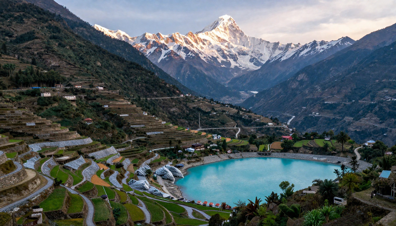
Rivers that rise in the Himalayas sustain some of the largest populations on Earth. The Indus, Ganges, and Brahmaputra river systems together provide water, food, and energy to nearly a billion people across South Asia. For centuries, these rivers have supported agriculture, trade, and settlements across the region.
Yet the same rivers that sustain life are increasingly becoming pathways for disasters. Rapid glacier melt, unstable mountain geology, intense monsoon rainfall, and expanding infrastructure are combining to make Himalayan river basins among the most flood-prone landscapes in the world.
The risks are not limited to the mountains themselves. Floodwaters that begin high in the Himalayas can travel hundreds of kilometers downstream, affecting densely populated plains across Nepal, India, Pakistan, and Bangladesh.
Understanding how these river systems work – and why flood risk is rising – is becoming central to climate resilience across South Asia.
Rivers Born in Ice and Monsoon
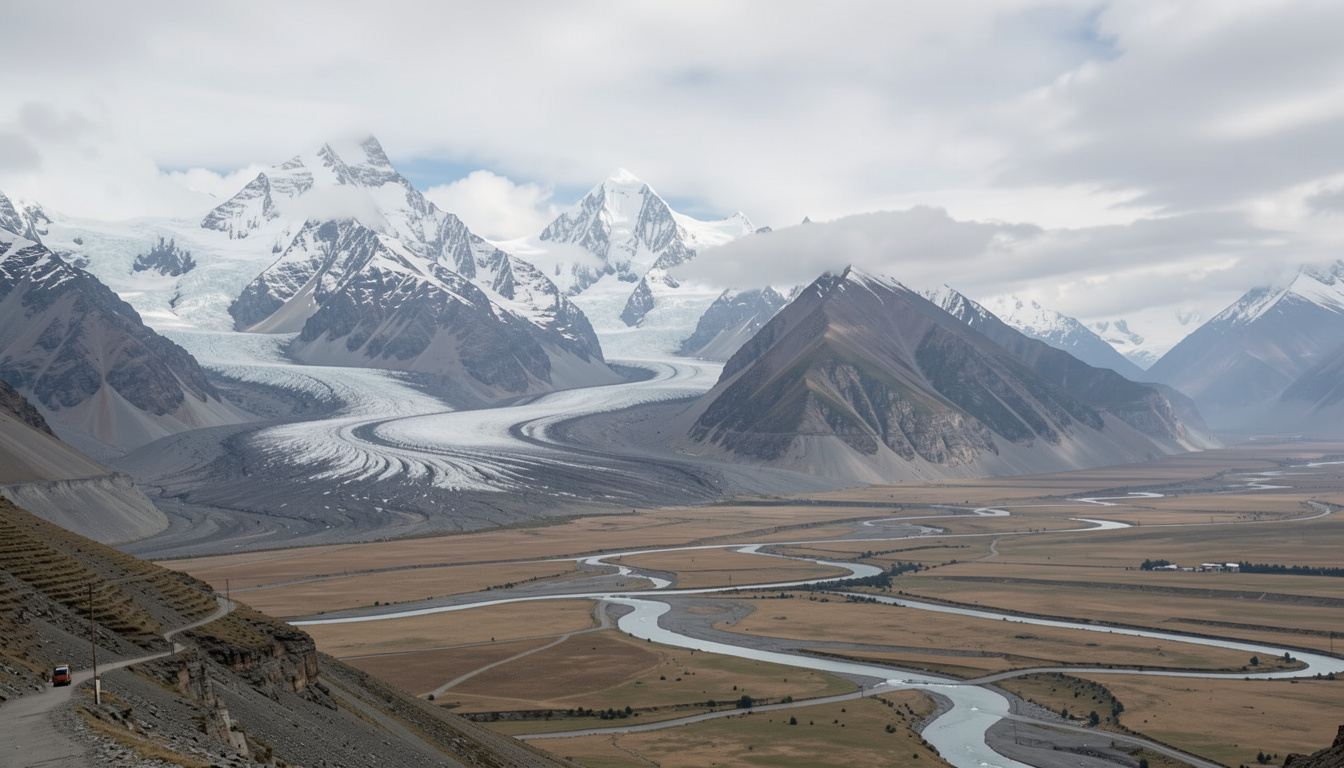
The Himalayan river systems are unique because they depend on two powerful water sources: glacier and snow melt, and seasonal monsoon rainfall.
In some basins, such as the upper Indus, snow and glacier melt contribute a large share of river flow. In others, including the Ganges and Brahmaputra, monsoon rainfall plays the dominant role. This combination creates powerful seasonal surges during the summer months.
When glacier melt and monsoon rains occur at the same time, river levels can rise rapidly. Under normal conditions these seasonal flows support agriculture and replenish groundwater. But when rainfall intensifies or slopes destabilize, the same process can produce destructive floods.
The Growing Threat of Glacial Lake Outburst Floods
One of the most dangerous hazards in the Himalayas is the glacial lake outburst flood, often referred to as a GLOF.
As glaciers retreat due to rising temperatures, meltwater accumulates behind natural dams made of loose rock and ice. These dams are fragile and can collapse suddenly, releasing massive volumes of water downstream.
Researchers have identified thousands of glacial lakes across the Himalayas, with several hundred considered potentially dangerous. When one of these lakes bursts, the flood wave can travel through narrow valleys at high speed, destroying bridges, roads, and settlements in its path.
A dramatic example occurred in October 2023 in the Indian state of Sikkim, when a glacial lake burst after heavy rainfall. The resulting flood surge rushed down the Teesta River, damaging towns and infrastructure and destroying a major hydropower facility within minutes.
Similar events have occurred in Nepal and Bhutan, where sudden glacial lake drainage has triggered floods that traveled far beyond the mountain valleys where they began.
Climate Change and the Expanding Risk Zone
Climate change is accelerating several processes that increase flood risk in Himalayan rivers.
Warmer temperatures are causing glaciers to melt faster and glacial lakes to expand. Satellite observations show that both the number and the size of glacial lakes in the region have been increasing over recent decades.
At the same time, climate change is intensifying rainfall patterns. Warmer air holds more moisture, which can lead to heavier downpours over shorter periods of time. These intense rainfall events increase the likelihood of flash floods and landslides in mountainous terrain.
The combination of glacier melt and intense rainfall can create cascading disasters. For example:
- A landslide falls into a glacial lake
- The lake bursts and releases a sudden surge of water
- The flood picks up rock, sediment, and debris
- Downstream dams, bridges, and towns are overwhelmed
These chain reactions are becoming more likely as climate conditions continue to change.
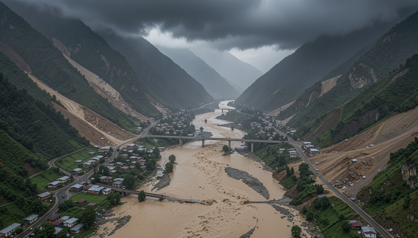
Fragile Mountains, Fast Water
The Himalayas are geologically young mountains. Their slopes are steep, unstable, and highly prone to landslides.
When heavy rain falls on these slopes, large volumes of soil and rock can slide into rivers, temporarily blocking the flow of water. These natural dams can hold back water for hours or even days before collapsing suddenly and releasing powerful flood waves downstream.
Flash floods in Himalayan valleys are therefore often a mixture of water, mud, rock, and ice. This debris makes the floods far more destructive than ordinary river flooding.
Because mountain valleys are narrow and settlements are often located close to rivers, even relatively small floods can cause severe damage.
Rising Exposure from Hydropower and Infrastructure
Human development is also increasing exposure to flood risk in the Himalayan region.
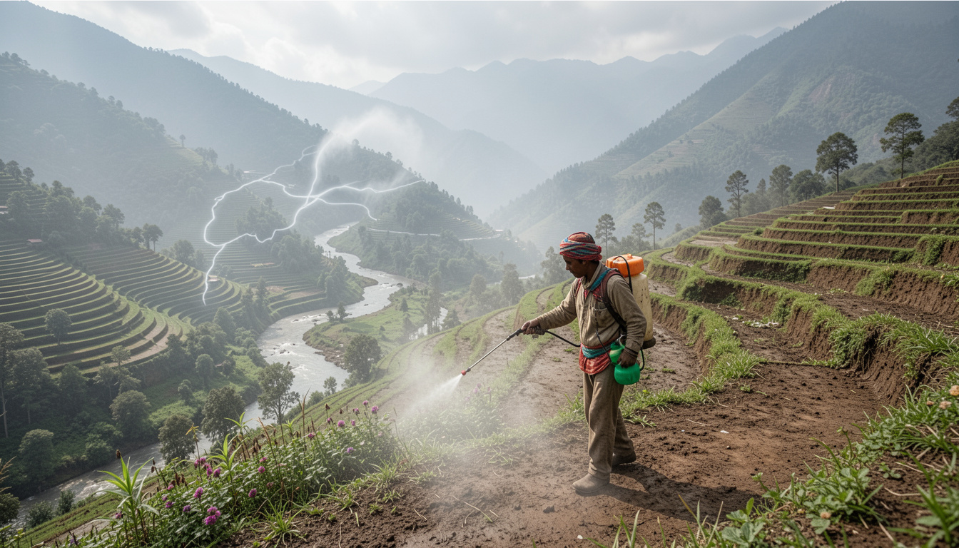
Many countries in South Asia are investing heavily in hydropower, roads, and mountain infrastructure to support economic growth. Hydropower projects, in particular, are expanding rapidly because Himalayan rivers offer enormous energy potential.
However, these projects often place critical infrastructure directly along river corridors.
When floods occur, damage can cascade through entire river systems:
- Dams and turbines damaged by debris flows
- Bridges and highways washed away
- Sediment clogging reservoirs and irrigation canals
- Power outages affecting large regions
Because mountain valleys provide limited space for relocation, infrastructure is often built close to rivers, increasing its vulnerability.
Downstream Consequences for South Asia
Flood risk in Himalayan rivers does not stop at national borders.
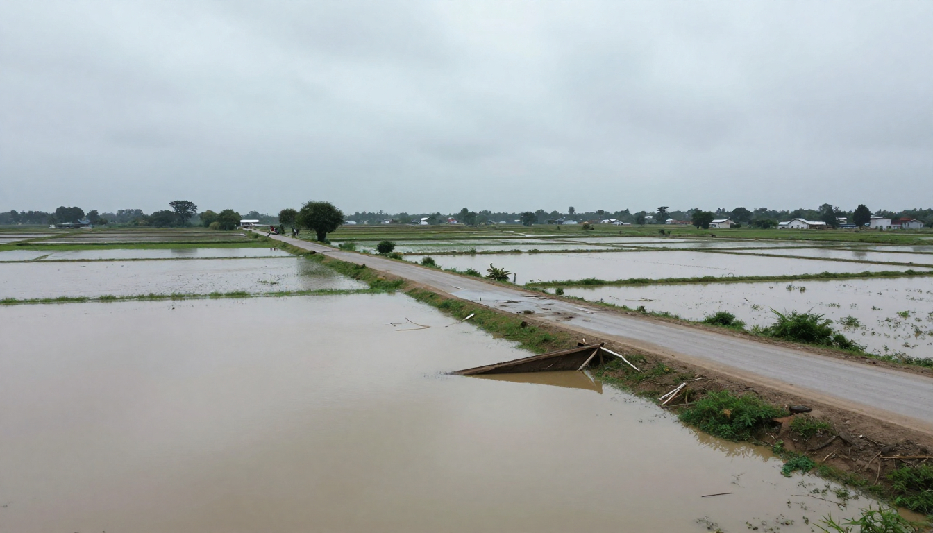
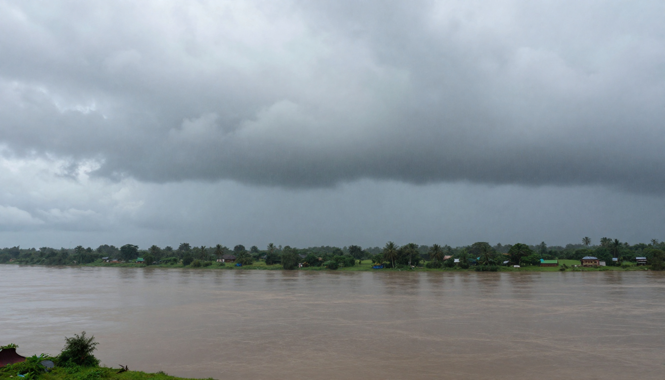
Water released in the mountains flows into the Indus, Ganges, and Brahmaputra river systems, eventually reaching the plains of northern India, Pakistan, and Bangladesh. These regions are among the most densely populated areas in the world.
When floods intensify upstream, the consequences can include:
- Large-scale crop losses across agricultural zones
- Riverbank erosion destroying farmland and homes
- Damage to roads, railways, and power networks
- Displacement of thousands or even millions of people
In delta regions such as Bangladesh, even moderate increases in river discharge can overwhelm drainage systems and embankments.
Monitoring the Mountains
Reducing flood risk in Himalayan river systems requires better monitoring and early warning systems.
Satellite observations, weather radar, and remote sensing technologies are increasingly being used to track rainfall, glacial lakes, and river flows in real time.
Scientists are also developing automated systems that analyze satellite imagery to identify potentially dangerous glacial lakes before they fail. These tools can help governments monitor remote mountain regions where traditional monitoring stations are limited.
Improved early warning systems can save lives by providing communities with time to evacuate before floods arrive.
The Future of Himalayan Flood Risk
The Himalayan region is often described as the “Third Pole” because of the vast amount of ice stored in its glaciers. That ice plays a critical role in regulating river flows across Asia.
However, as temperatures rise, glaciers are retreating and the balance of these water systems is changing. Scientists warn that significant glacier loss during the coming decades could alter river flows, increase flood hazards, and create new risks for downstream populations.
For millions of people living along Himalayan rivers, the challenge is not simply preventing floods, which may be impossible. Instead, it is about building resilience — strengthening infrastructure, improving early warning systems, and planning development in ways that reduce exposure to future disasters.
What begins as a glacial lake high in the mountains can become a flood hundreds of kilometers downstream. As the climate continues to change, the rivers of the Himalayas may carry not only water, but also the growing risks of a warming world.