The Himalayan region is often called Asia’s “Water Tower.” The term refers to the vast network of glaciers, snowfields, and rivers that originate in these mountains. Together, this Himalayan water tower carries water across borders, seasons, and economies, supporting nearly two billion people downstream.
These systems depend on a fragile balance between glaciers, seasonal snow, and monsoon rainfall. That balance is now shifting – not abruptly everywhere, but unevenly, quietly, and with long-term consequences.
Major Himalayan River Systems
| River System | Basin Countries | Estimated Population Supported (Direct / Indirect) | Dominant Water Source |
|---|---|---|---|
| Indus | Pakistan, India | ~200 million / ~500 million | Snow and glacier melt |
| Ganges | India, Bangladesh, Nepal | ~400 million / ~1 billion | Monsoon rainfall, Himalayan tributaries |
| Brahmaputra | India, Bangladesh, China, Bhutan | ~100 million / ~600 million | Monsoon-dominated with melt peaks |
| Yangtze | China | ~400 million | Glacier-fed headwaters |
Together, these river basins span more than 2,000 kilometers and support agriculture, energy production, and daily water needs across South and East Asia.
Nepal’s Upstream Contribution
Despite its relatively small land area, Nepal plays a disproportionate role in Himalayan hydrology.
| Indicator | Value |
|---|---|
| Contribution to Ganges flow at Farakka | ~47% annually |
| Contribution during dry months (Mar–May) | Up to 75% |
| Average annual discharge to India (9 rivers) | ~5,675 m³/sec |
This upstream flow stabilizes water availability during dry seasons, especially when rainfall is low in downstream regions.
Across the Himalayan river systems, water from these mountains irrigates crops for over 129 million farmers and supports approximately 26,000 MW of hydropower generation, with far greater potential yet to be developed.
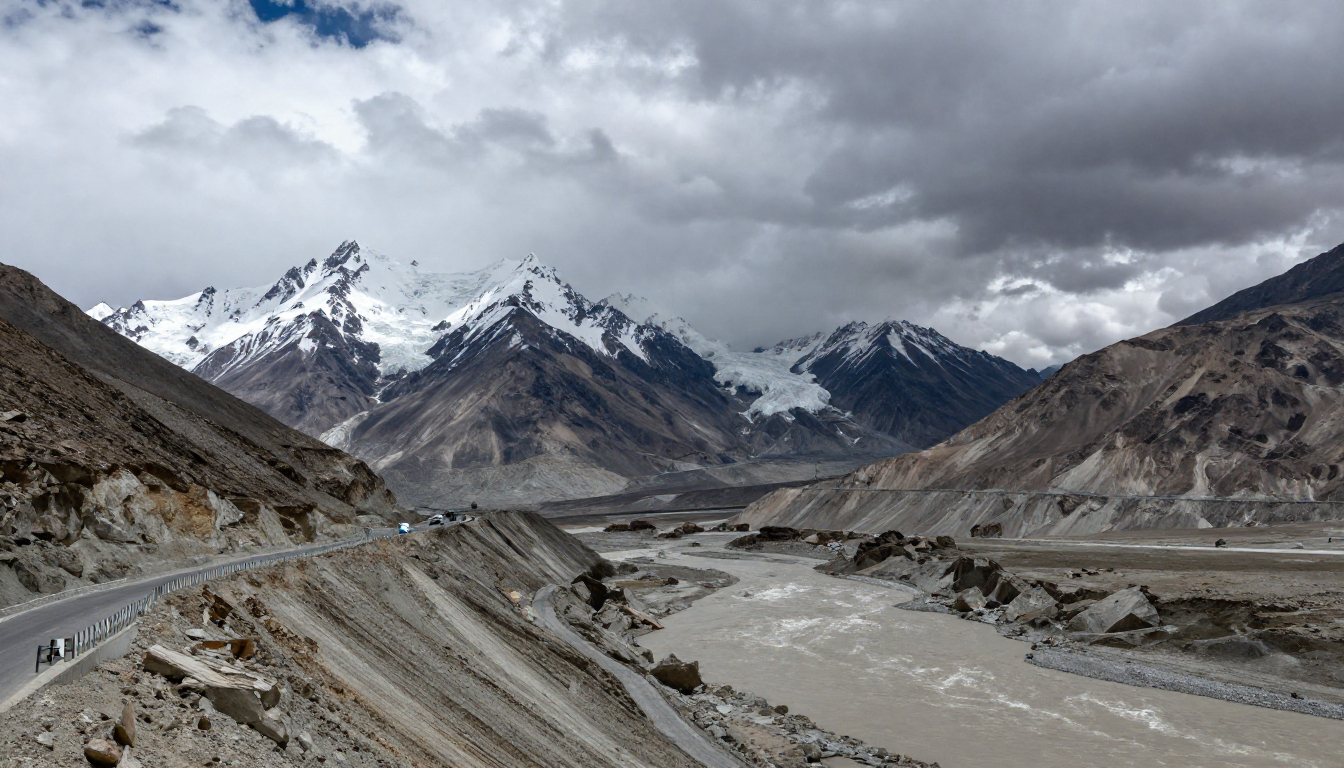
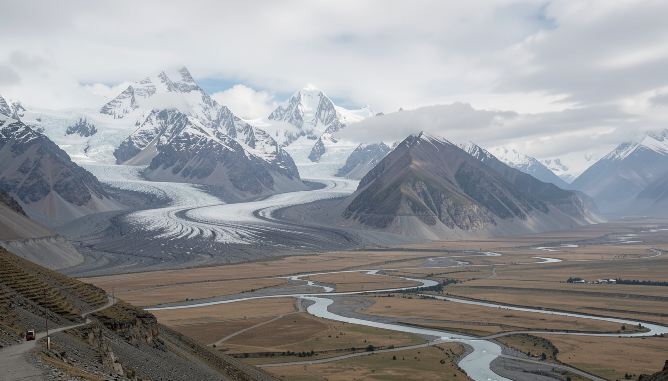
The Role of Glaciers and Snowmelt
Outside the polar regions, the Himalayas contain the largest concentration of glaciers on Earth — around 5,000 in total. These glaciers do not provide constant flow, but seasonal regulation.
| Basin Type | Share of Annual Flow from Snow & Glacier Melt |
|---|---|
| Western basins (e.g., Indus) | High dependence |
| Central Himalayan rivers | Moderate |
| Eastern basins (Ganges, Brahmaputra) | Lower, but stabilizing |
Across basins, meltwater contributes anywhere between 5% and 66% of annual river flow. In some regions, particularly during autumn, this contribution can rise above 50%, sustaining rivers when rainfall declines.
In Nepal’s high-altitude regions, rivers such as the Dudh Koshi play a critical role in maintaining flows in the larger Koshi system during dry periods.
Water Knowledge Before Modern Hydrology
Human understanding of Himalayan water systems long predates modern climate science.
The Indus Valley Civilization developed advanced drainage and water storage systems over four thousand years ago. The Great Bath at Mohenjo-Daro is widely considered one of the earliest public water structures designed for collective use.
During the Mauryan period, states built dams and reservoirs, measured rainfall, regulated spillways, and even priced water use. Across Himalayan slopes, terraced farming and gravity-fed channels allowed communities to manage snowmelt with minimal external intervention.
These systems relied on observation and adaptation – not prediction.
Climate-Driven Shifts in Flow
Rising temperatures are accelerating glacier retreat across the Hindu Kush–Himalayan region. Current projections suggest substantial long-term losses.
| Warming Scenario | Estimated Glacier Loss by 2100 | Expected River Flow Impact |
|---|---|---|
| 1.5–2°C | 30–50% | Increased variability |
| 3–4°C | 75–80% (Eastern Himalayas) | Reduced dry-season flows, especially Indus |
In the short term, faster melting may increase river discharge. Over time, reduced snow storage is expected to lower dry-season flows, particularly in melt-dependent basins.
Black carbon – fine soot from combustion – has further accelerated melting in some regions by increasing heat absorption on snow and ice surfaces.
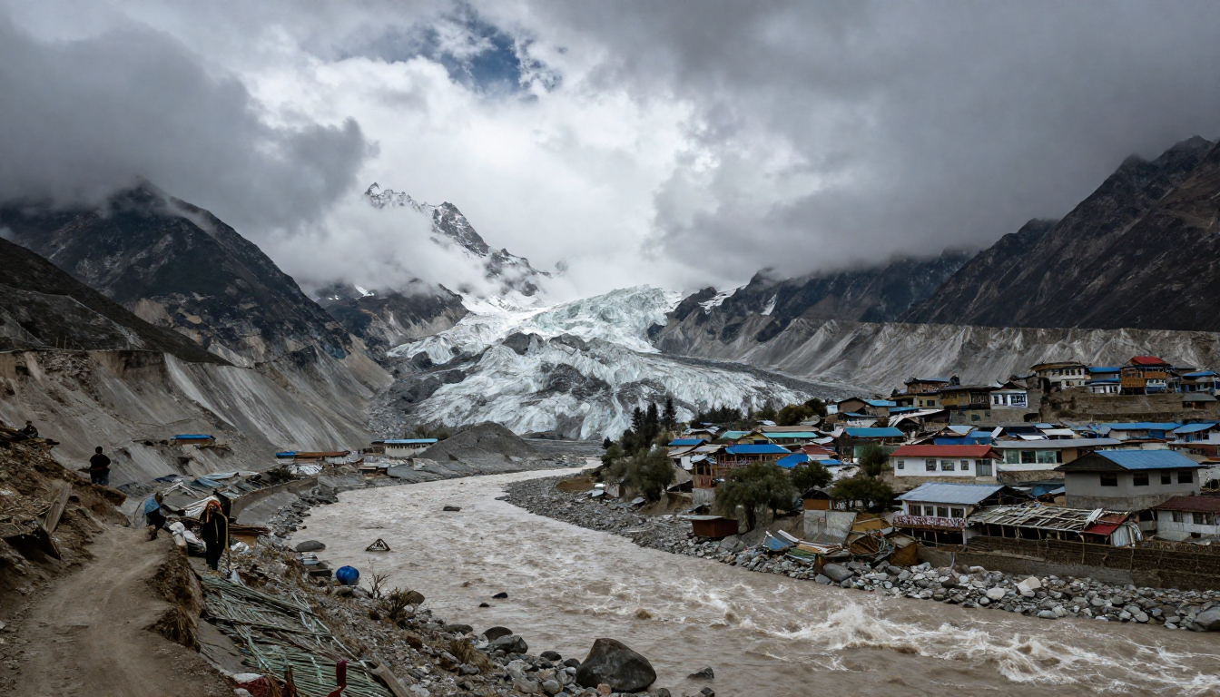
Glacial Lakes and Sudden Risk
As glaciers retreat, unstable lakes form behind natural dams of ice and debris. Across the Himalayan region, more than 5,000 glacial lakes have developed.
| Indicator | Number |
|---|---|
| Recorded GLOF events (since 1900) | 388 |
| Events in Pakistan | 131 |
| Events in China | 123 |
| Events in Nepal | 54 |
| High-risk lakes in Nepal | 42 |
| People potentially exposed (Nepal) | ~2.3 million |
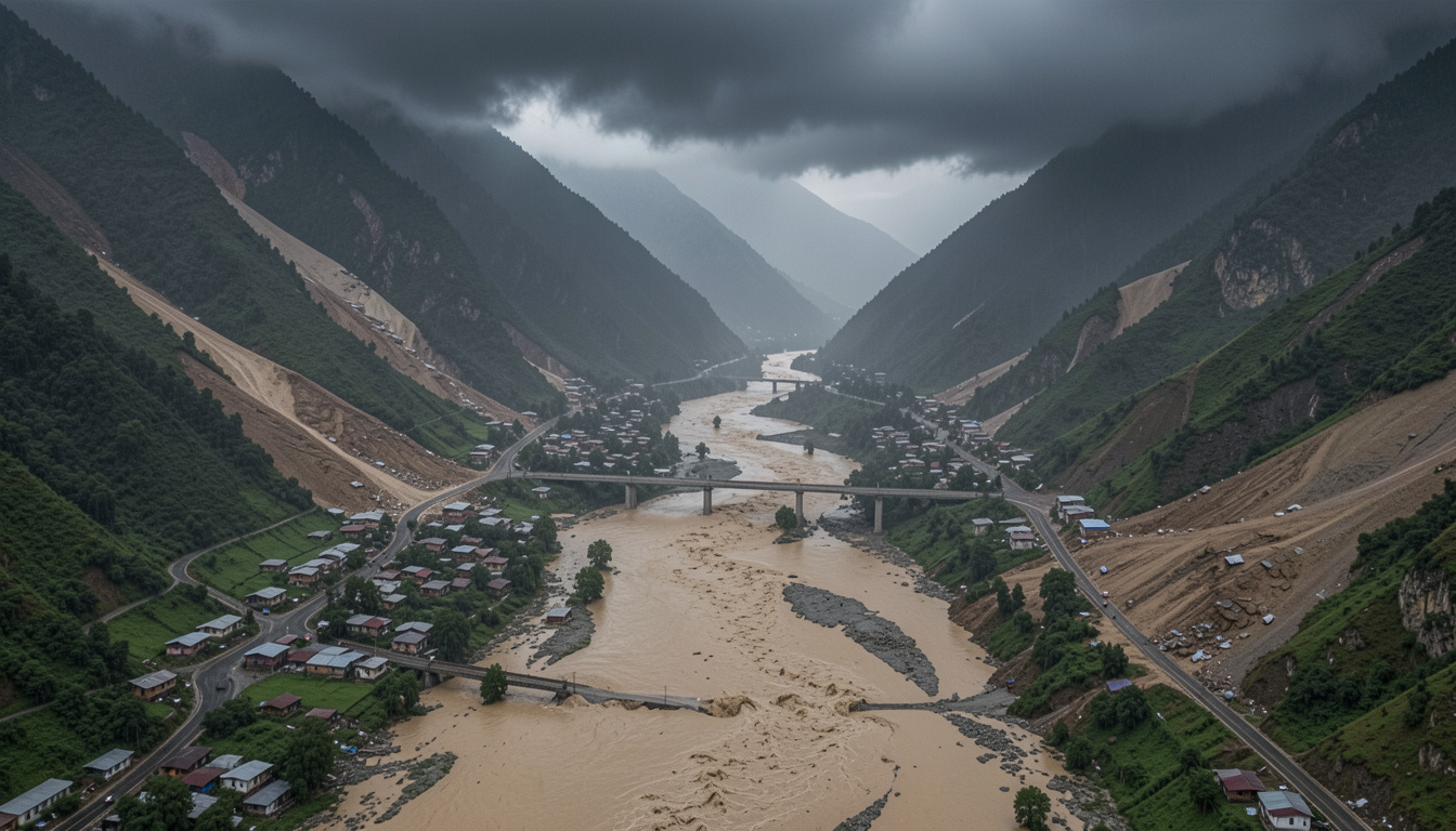
When these lakes fail, floods arrive without warning, destroying farmland, settlements, and infrastructure. Past events such as Dig Tsho in Nepal and Kedarnath in India illustrate how quickly mountain water can turn destructive.
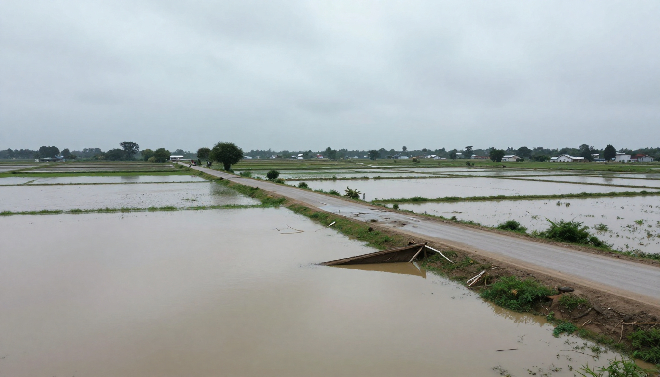
Downstream Effects That Build Slowly
Floods attract attention. Water scarcity does not.
Reduced dry-season flows strain irrigation systems, hydropower reliability, and food production in downstream regions. For the Indus basin, declining summer flows threaten some of the most water-stressed agricultural zones in South Asia.
Roughly 240 million people living in mountain regions, along with an estimated 1.6 billion downstream, depend on the stability of Himalayan water systems. For Nepal and Bhutan, hydropower exports are central to national economies. For large parts of India and Pakistan, steady river flow remains essential for food security.
Holding a System Under Pressure
Monitoring glacial lakes, improving early-warning systems, and lowering water levels in high-risk lakes are increasingly necessary measures. Nepal alone has invested tens of millions of dollars in such interventions.
These efforts reduce risk, but they do not replace the slow seasonal balance that once defined Himalayan hydrology.
The Himalayas have sustained life for thousands of years. Their water systems still do – but under growing strain. What happens upstream will continue to shape lives downstream, often long before the change becomes visible.